Loss of Georgian Bay
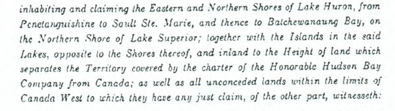
The Ontario
government is misleading the public into believing that it must give substitute islands in Georgian Bay to Wiikwemkoong Band, islands that tens of
thousands of Ontarians have used for generations. Ministry of Indigenous Affairs confirmed that it will give Ontario crown land to promote economic, cultural and community development for
natives disguised as a valid land claim. Land claims are no longer just about
treaties and there is no accountability to
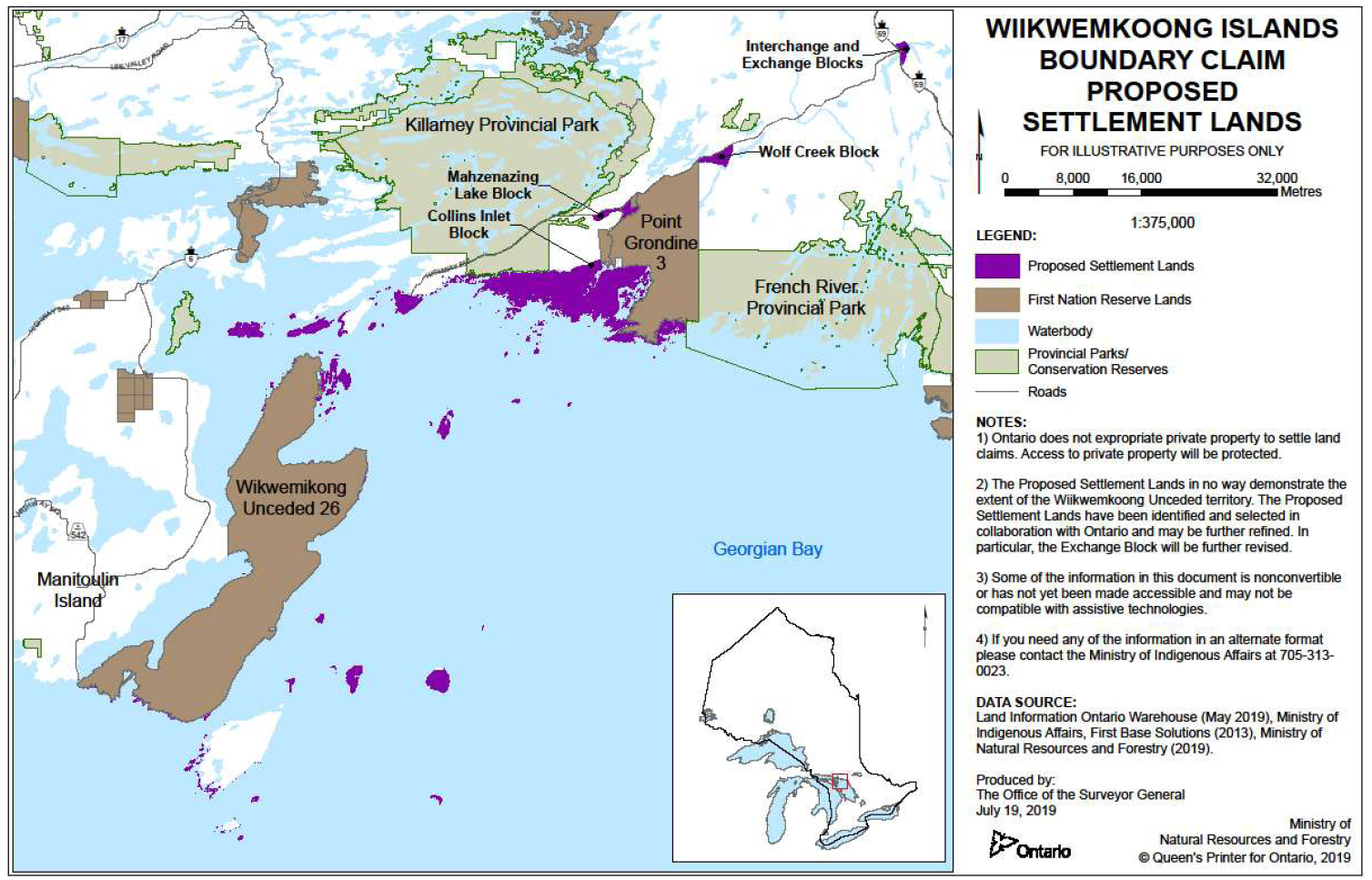
the public. Kayakers, canoers and boaters will be denied access to most of northern Georgian Bay shoreline from Killarney to French River. Taking thousands of islands worth over a billion dollars from public use and giving them to natives with no connection to these islands is not fair nor just. The fact that non-natives, not the Wiikwemkoong, have used these islands for many generations is being ignored by the government.
For example, he said it is difficult to prove the nation had used the land because they primarily travelled by canoe, so there were no established trails between coastal locations. He wrote that this case may be indicative of the need for a "reconsideration of the test for Aboriginal title as it relates to coastal First Nations."
Wiikwemkoong are claiming fishing islands near their reserve and as they emigrated to Canada in 1830’s it is inconceivable that they were able to use most of these lands and islands that they are claiming. As a Supreme Court Judge has stated, there is a need for a "reconsideration of the test for Aboriginal title as it relates to coastal First Nations."
Governments must show leadership and Minister Rickford is looking the other way.
How is it possible that a claim for land to build fishing huts on 41 islands can expand to thousands of kilometers of Georgian Bay shoreline and tens of thousands of islands encompassing much of Georgian Bay? This is the second land claim by Wiikwemkoong, (aka Wikwemikong) the first one being settled in 1995 with Wikwemikong receiving $13,900,000 of Canadian taxpayers’ money and a tripling of their Point Grondine ceded reserve. The value of the land was not disclosed to the public.
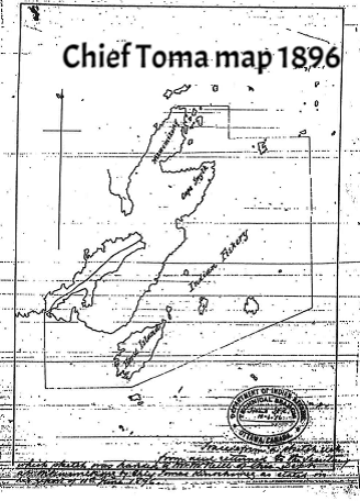
Ontario has withheld vital information pertaining to this current "give-a-way" but many of these documents have been obtained from other sources and are available for download under the "Documents" tab. For example, the 1896 Toma map of the 41 islands referenced in the claim does not include Philip Edward or George Island.
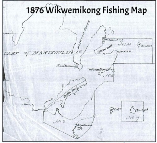
Even more disturbing is the discovery of an earlier map from National Archives. This 1876 map shows the indigenous fishing area of Wikwemikong to be smaller than the later Toma map. The map shows fishing between Fitzwilliam Island and Manitoulin but not around Fitzwilliam Island. It does not show Philip Edward Island or any of the surrounding islands near Killarney Park, and it does not show George Island in Killarney. The government is relying on an altered map to mislead the public.